Geomap
The Geomap widget tracks devices on a map in real time, drawing a trail behind each one as it moves. It is built for tracking: vehicles, assets, anything that reports its own position and is expected to change it.
It is a separate widget from the Map widget, and the two are for different jobs:
| Geomap | Map | |
|---|---|---|
| Built for | Seeing where a device has been | Seeing where devices are now |
| Shows | A live marker and its recent trail | Positions, saved map views, overlay images, geofences |
| Needs | Devices reporting their own position | Any device with a position |
For placing devices by hand on a building image, use the Floor plan widget instead.
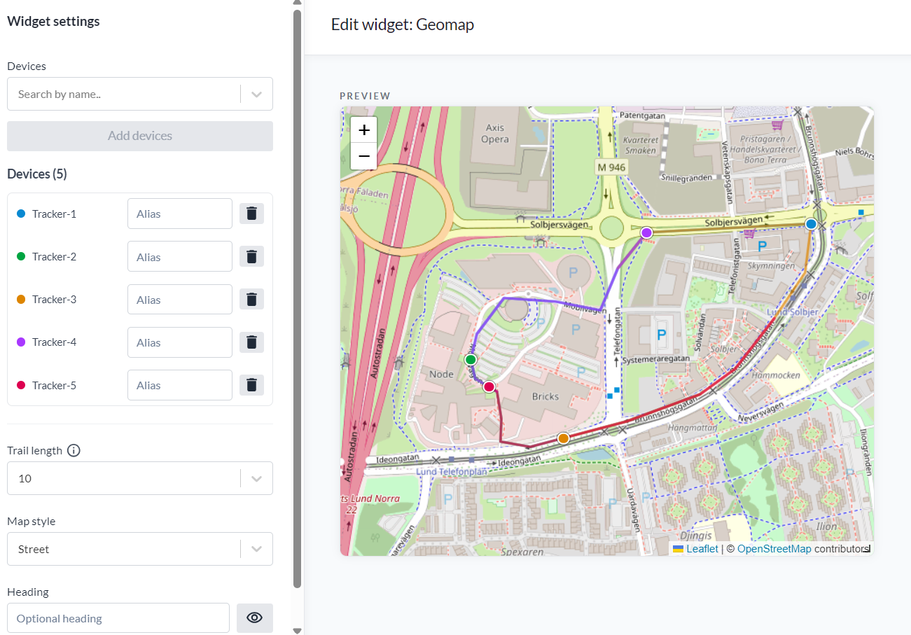
Setup
- Under Devices, select the devices to track. The widget needs at least one.
- Press Add devices.
- Give a device an Alias if the marker should be labelled with something other than the device name.
A device that has no position yet is listed as No location, and the widget shows "Waiting for device positions" until one arrives.
The preview beside the settings draws the trails as you configure them, so you can see whether the trail length suits how far the devices actually move before saving the widget.
Options
| Setting | What it does |
|---|---|
| Trail length | How many recent positions to keep behind each device: Markers only, 10, 20, 50, 100 or 200. The default is 20 |
| Map style | The background map, the same styles as the map page |
| Heading | An optional heading for the widget. The toggle beside it shows or hides the heading |
Markers only draws the current position with no trail, which is the readable choice when several devices move through the same area.
How the trail is built
Positions are polled every 15 seconds. On load the trail is seeded from the last 24 hours of the device's position history, so a dashboard you have just opened is not blank.
A gap of more than 30 seconds between two positions breaks the trail rather than joining it. A dashboard left closed, a throttled browser tab or a sleeping device would otherwise draw one long straight line across a journey that was never made. The trail restarts from the current point instead.
The trail is capped at the trail length you set, counted in positions and not in time. A device reporting every few seconds therefore shows a shorter stretch of road than one reporting every minute.
The position comes from the device's own lnglat time series. A device whose position is set by hand
in Position does not move and has no trail to draw.